From Remote Sensing to Measurable Impact on the Golf Course
Jim Pavonetti, CGCS | Fairview Country Club, Greenwich, Connecticut
"Managing a golf course with consistently excellent playing conditions is challenging when every acre presents different growing conditions. At Fairview Country Club, elevation changes, trees, shade, rocky terrain and heavy soils create considerable variability. Incorporating satellite-based monitoring into our operation has given us a new perspective on these challenges."
Using Soil Moisture Data to Diagnose Irrigation Issues
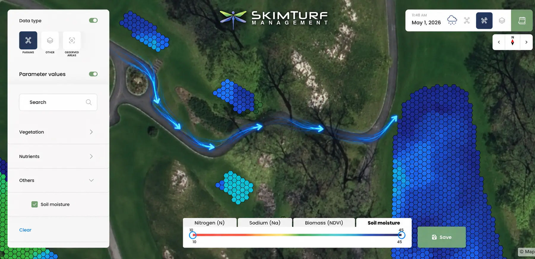
"One of our most revealing experiences involved an unusually wet area on our fifth fairway. SkimTurf's soil moisture imagery consistently showed significantly higher moisture levels there than elsewhere on the course. At first, I suspected a sprinkler must be not turning at night, or it has a bad O-ring and was spilling water all over that area of the fairway. However, field inspections confirmed that every sprinkler in the area was operating correctly. Going back to the satellite image, I finally realized that a nearby tee always needed extra water, but its sprinkler was also watering an adjacent cart path. Water was running down the path and collecting on the fifth fairway, precisely where our satellite imagery had identified the anomaly. With some quick nozzle changes, we were able to eliminate that “over-watering” scenario and by the next satellite image, the wet area had disappeared. This experience demonstrated the value of auditing the entire course, so now we use soil moisture maps to assess irrigation performance during dry periods and drainage performance following significant rainfall."
Detecting Turf Stress Before It Becomes Visible
"Since the pandemic, our rounds have doubled, making traffic management increasingly important. I use vegetation indices to monitor traffic stress patterns, whether they are being caused by foot traffic, golf carts, or my own staff. Most importantly, we can detect stress in the satellite data before visible deterioration appears in the field. When we identify developing stress, we redirect traffic using signage or ropes, then evaluate the results in subsequent images. SkimTurf images are the “eye in the sky” scouting that makes this so much easier than waiting for the turf to thin out or show visible signs of stress, where it might already be too late. Satellite imagery also makes our team more efficient. Rather than spending valuable time searching for problems, we can display maps on our app or print them to direct staff precisely where attention is needed."
Turning Remote Sensing Into More Efficient Course Management
"Since no two years are the same, it’s tough to quantify just how much labor is actually saved. I like to think of it as I’m able to direct what would have been wasted labor to more detailed type work that makes our course so much better and more fun to play. Even as a seasoned turf professional, I thought I was pretty good at growing grass and was reasonably successful most seasons. When I began to incorporate data collecting into my operation, the course got better, the operation more efficient, the decisions quicker and more accurate, and it showed me where I was doing great and where I was lacking and didn’t even know it."